Your shortlist, mapped
Put the land you're looking at on the map.
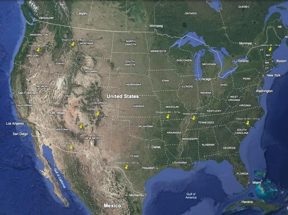
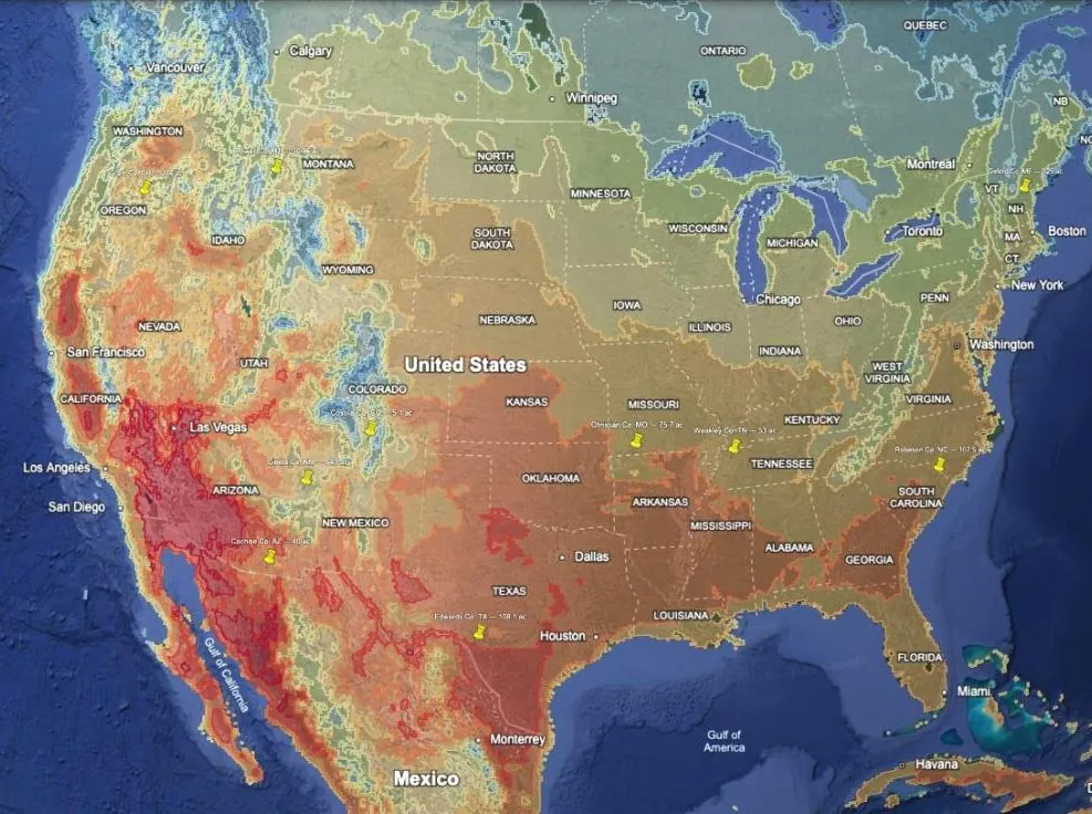
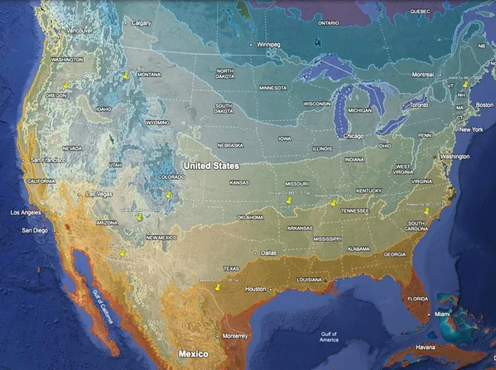
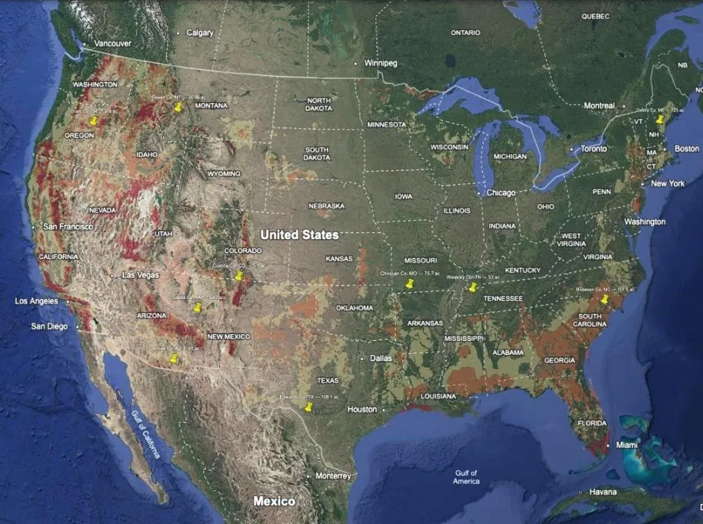
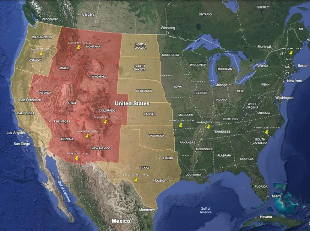
Send me links to the listings you are considering. You get back one Google Earth file with a pin on every property and an approximate boundary traced from public parcel records. That file loads alongside the layers, so you can see where each property sits on every one of them. $50 for 5 properties.
Screen the shortlist, not just the region
The layers rank and shade places. Your shortlist is a handful of specific properties. With both in one project, each layer you switch on answers a question about every property at once. Turn a layer on, see which pins it lands on, cross off what fails, then turn on the next.
Then zoom in
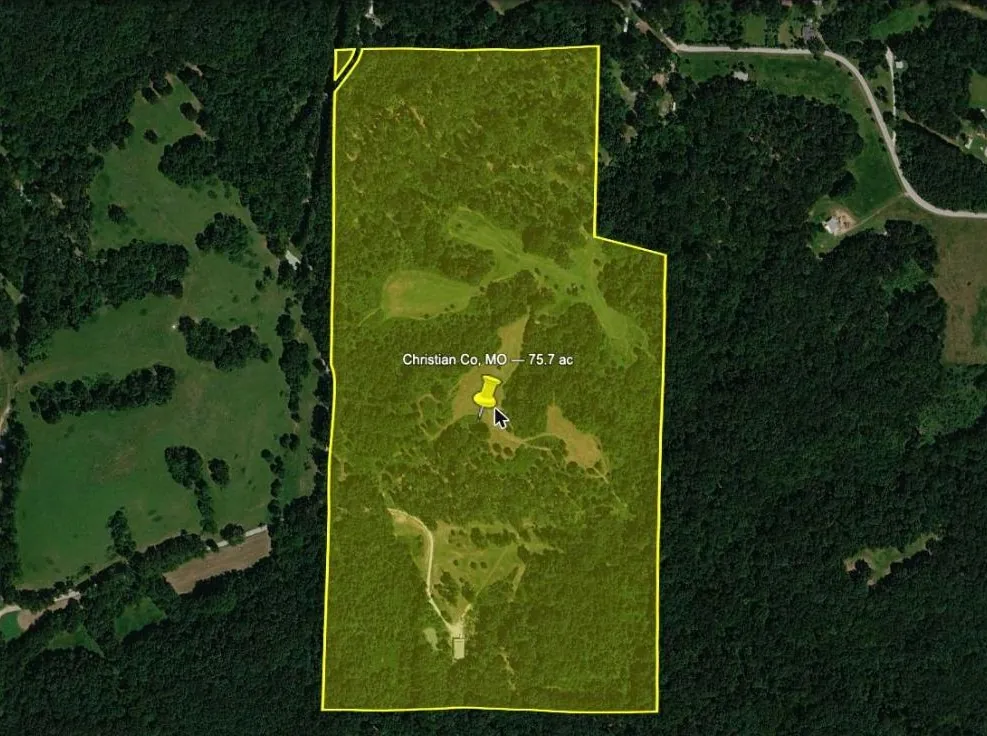
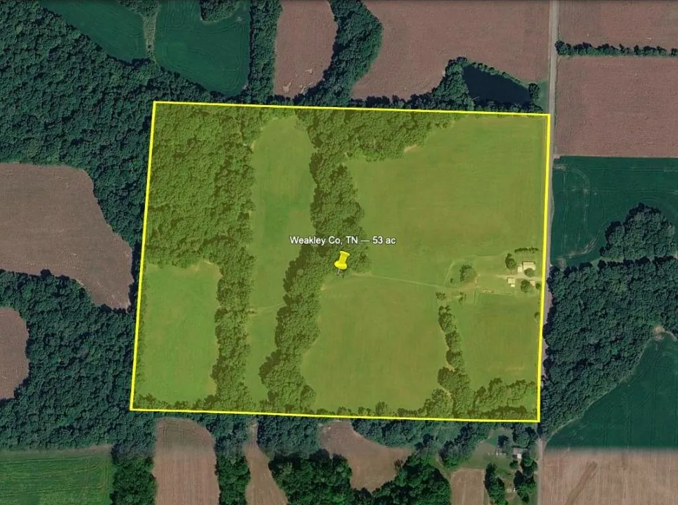
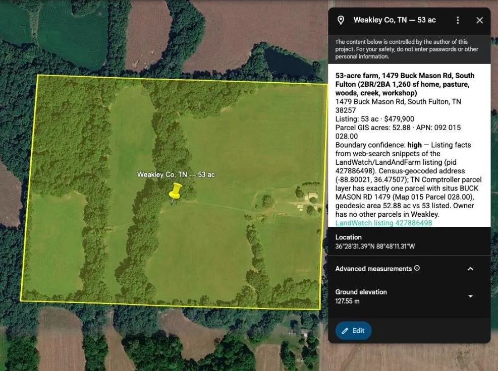
Each boundary is drawn from the county or state parcel layer: the lines the assessor taxes, not a survey. That is usually close enough to see what the listing photos leave out, such as where the tree line is, what the neighbours are farming, and how the property meets the road.
How it works
- Email me the listings. Write to support@preparedground.com with 5 listing links, or addresses or parcel numbers if you have them. Say if you already own the complete map. Which links work best is below.
- Pay by reply. $50 for the 5, or $25 if you own the complete map or buy it in the same email.
- I find each property in public records. I match it to the county's parcels by location, acreage and legal description, combining parcels where a listing spans several.
-
You get one file by email: a
.kmlwith a pin and a boundary for every property. Import it into Google Earth the same way as any layer.
Which links to send
Links from these sites map fastest and most accurately, because the listing carries its own location and often the broker's boundary:
- LandWatch, Lands of America or Land And Farm: the same listings on all three, and the largest rural-land inventory.
-
Land id map links (
id.land/maps/…), which brokers often share with their listings: the broker's own boundary. - RE/MAX listing pages.
- LandSearch listing pages.
Zillow, Realtor.com, Redfin and other sites are fine too. They may just take longer to match, so if a listing is on one of the sites above as well, send that link instead.
What "approximate" means
Parcel layers come from tax maps. In most counties they line up with the ground to within a few yards. In some older rural maps a line can be off by much more than that. Each property in the file is marked high, medium or low confidence, along with what the match rests on and how the parcel's acreage compares to the listing's.
Some listings don't follow parcel lines. They may be part of a parcel, or a tract the seller is splitting off. Where the broker has published their own boundary map I use it and say so. Where nobody has, you get the pin and a note on what the records do and don't show. If I can't find a property in public records at all, I tell you, and you can send another in its place.
This is not a survey. It says nothing about title, easements, flood zone or deeded access, and it is no basis for a boundary dispute. Get a survey before you buy.
The listings you send stay private. They are not published, resold, or added to any layer.